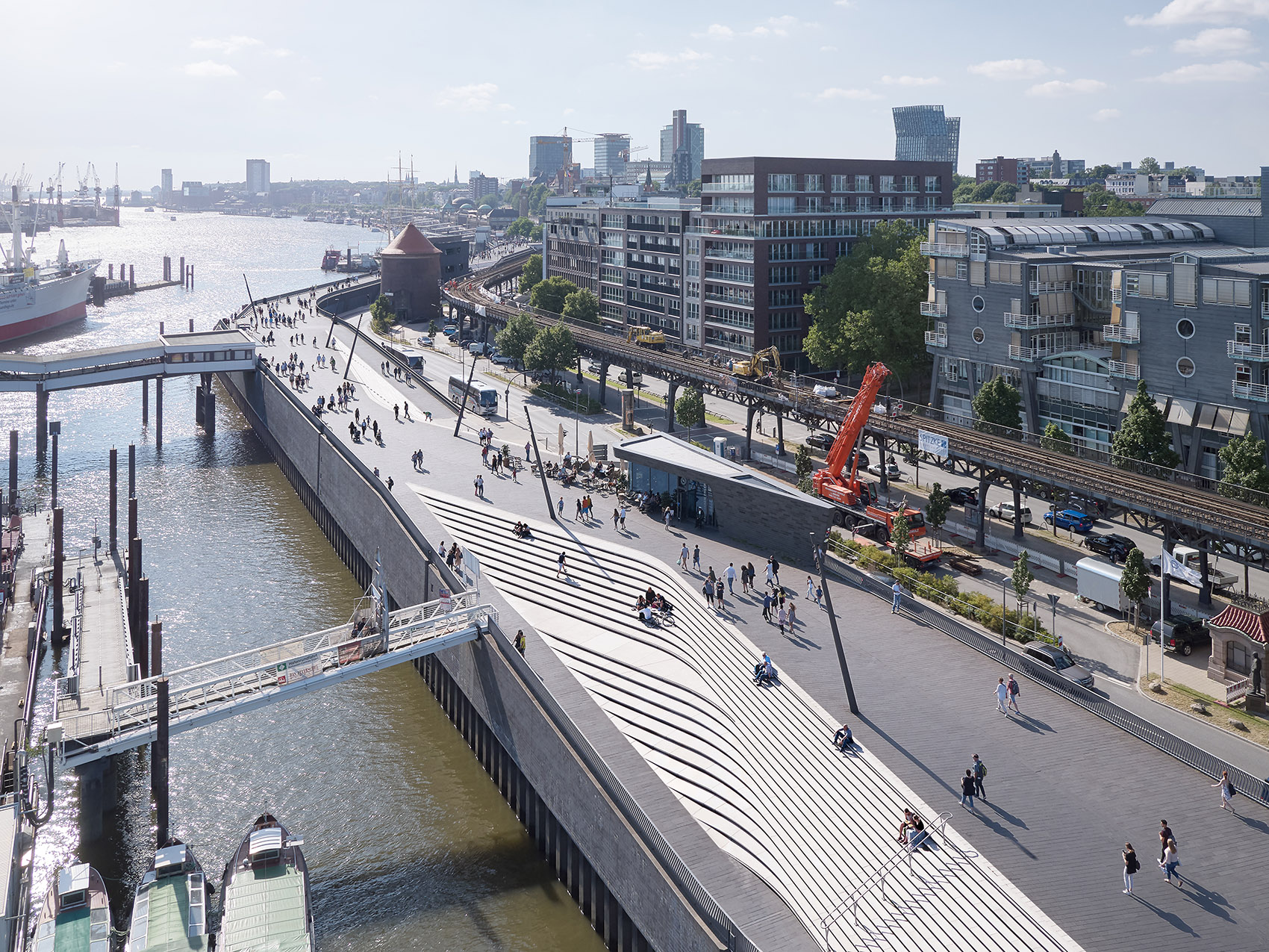
该项目位于汉堡易北河岸的Niederhafen(介于Landungsbrücken和Baumwall之间),长达652米的河滨走廊对城市防洪系统的优化与加固起到了不可或缺的作用。
Located at Niederhafen on the Elbe River between St. Pauli Landungsbrücken and Baumwall in Hamburg, the upgraded 625m river promenade is integral to the modernisation and reinforcement of the city’s flood protection system.
▼长达652米的河滨走廊沿着易北河岸伸展,the upgraded 625m river promenade extends along the Elbe River

1962年2月发生的风暴潮曾导致315人死亡,并有6万居民流离失所。在1964年至1968年间,汉堡市在Niederhafen修建了一道屏障,以防城市受到洪水的影响,其防洪高度最大可达到海拔7.2米。现代水文地理学以及计算机模拟技术已经能够更加准确地分析并预测城市的洪水特征。经过计算后得出的结论是,既有河堤的高度需要再增加0.80米,才能够保证汉堡市不受未来冬季风暴潮和极端浪潮的影响。基于2006年对Niederhafen防洪河堤的检测可以确定,既有结构的支撑元件已不堪重负,需要对基础部分进行全面的加固。为此,汉堡市发起了重建防洪堤坝的设计竞赛,并最终由Zaha Hadid Architects赢得比赛。
In the aftermath of storm surge floods in February 1962 that caused 315 fatalities and destroyed the homes of 60,000 residents, between 1964 and 1968 Hamburg developed a barrier on the banks of the Elbe at Niederhafen to protect the city against floods up to a height of 7.20m above sea level. Modern hydrology and computer simulations have since analysed and forecast the city’s flooding characteristics with greater accuracy; calculating that an increase in the barrier height of 0.80m was required to protect Hamburg from future winter storm surges and extreme high tides. Inspections of Niederhafen’s existing flood barrier in 2006 determined that supporting elements of the existing structure were overburdened and its foundations needed significant reinforcement. At this time, the city of Hamburg organized a competition to design the redeveloped flood barrier and subsequently awarded the project to Zaha Hadid Architects.
▼河滨走廊概览,Niederhafen River Promenade overview
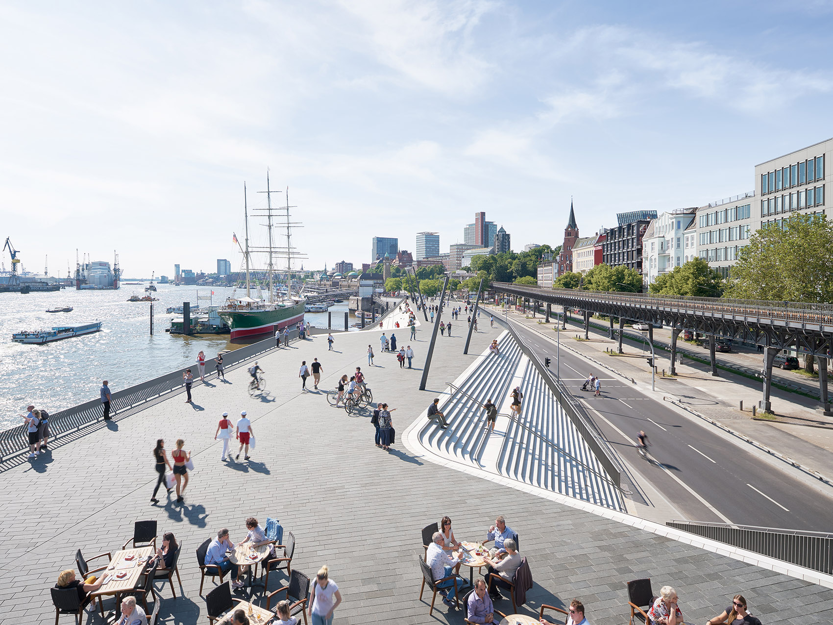
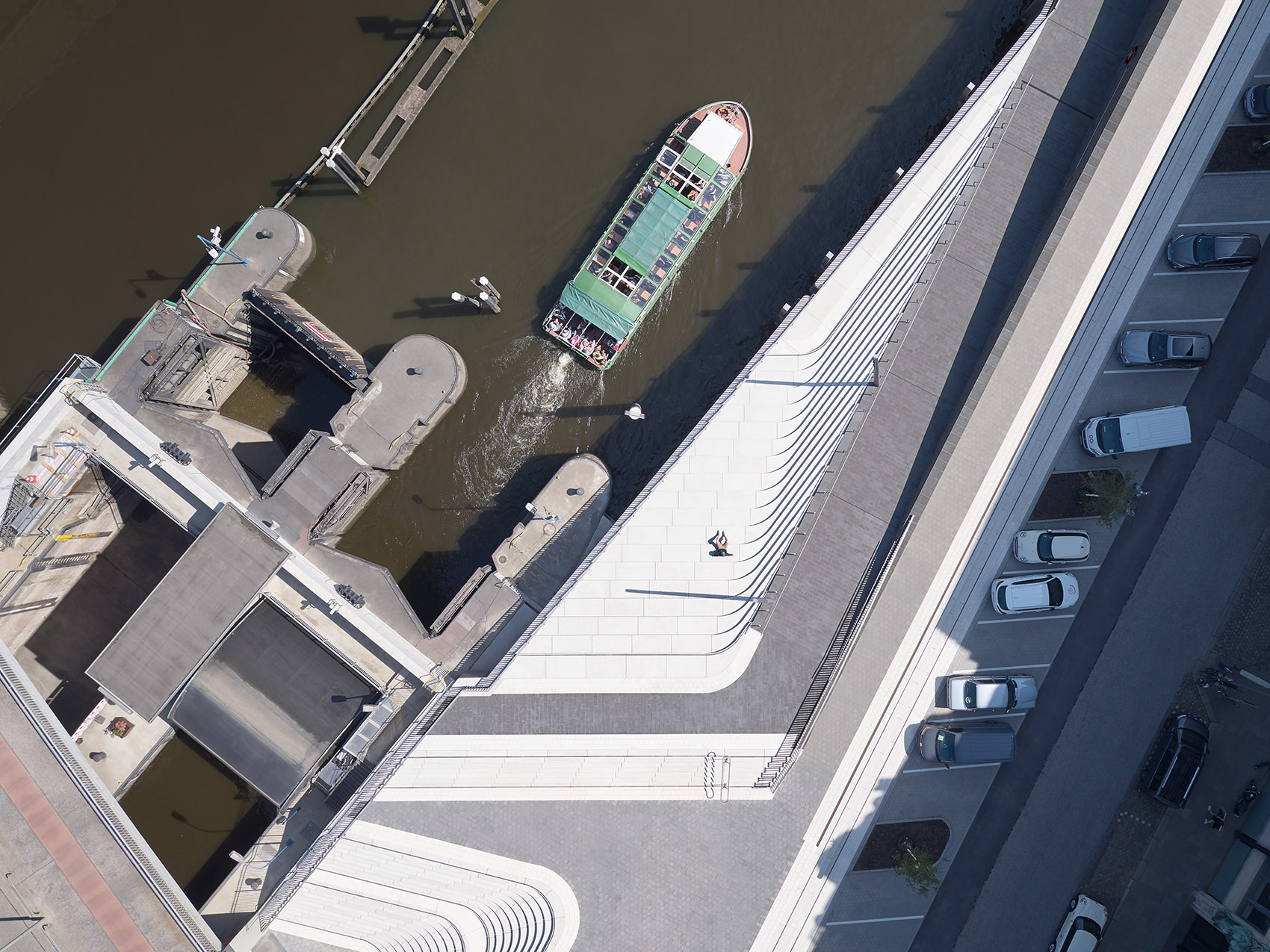
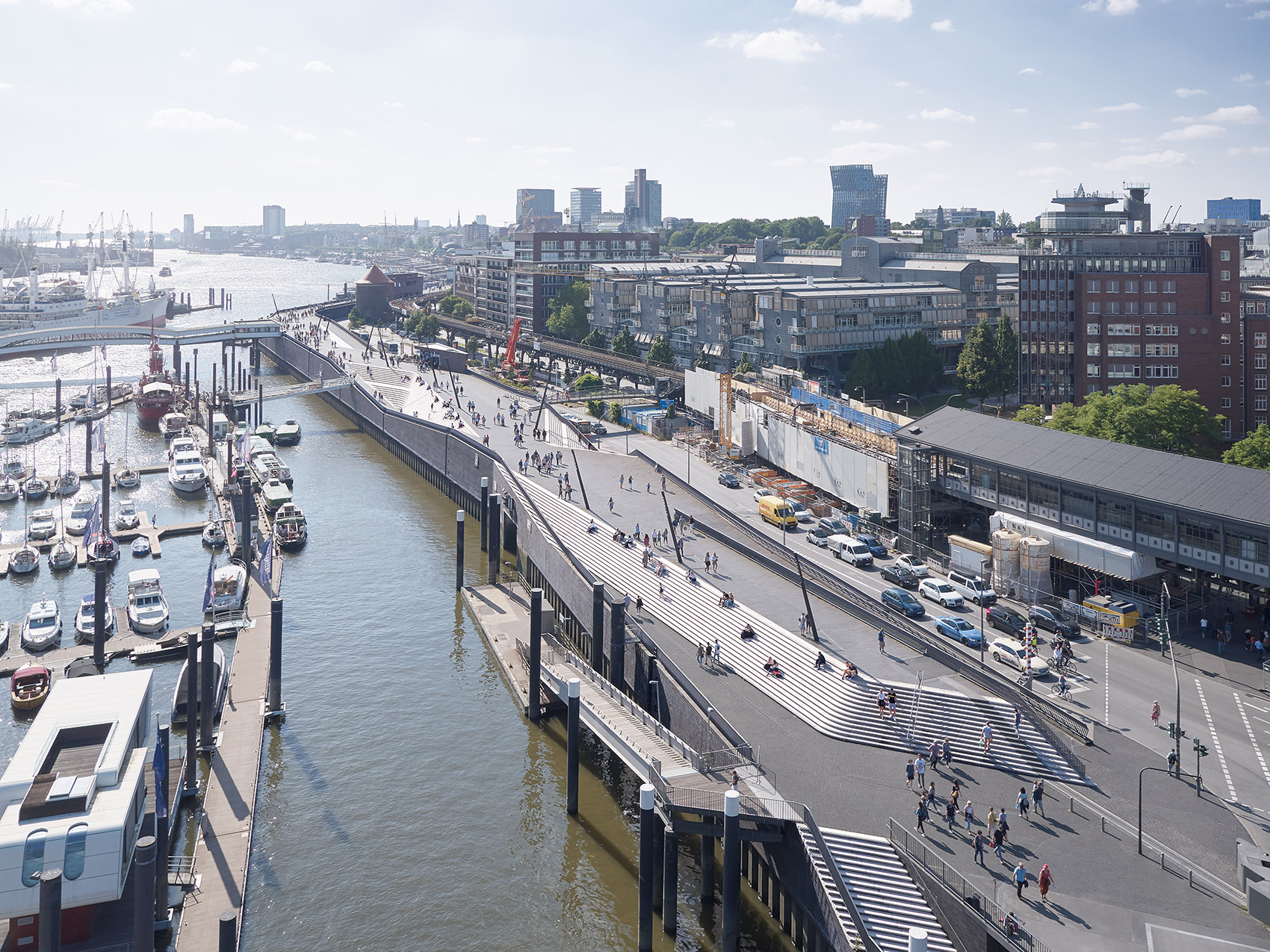
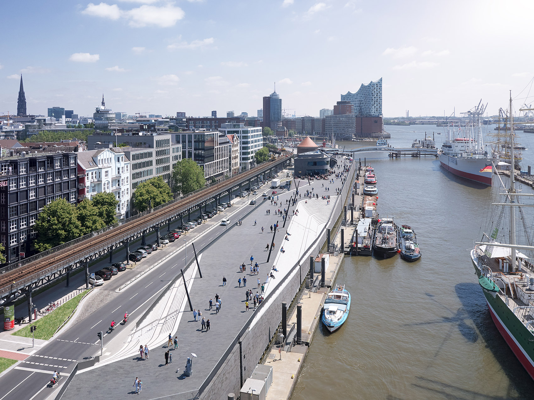
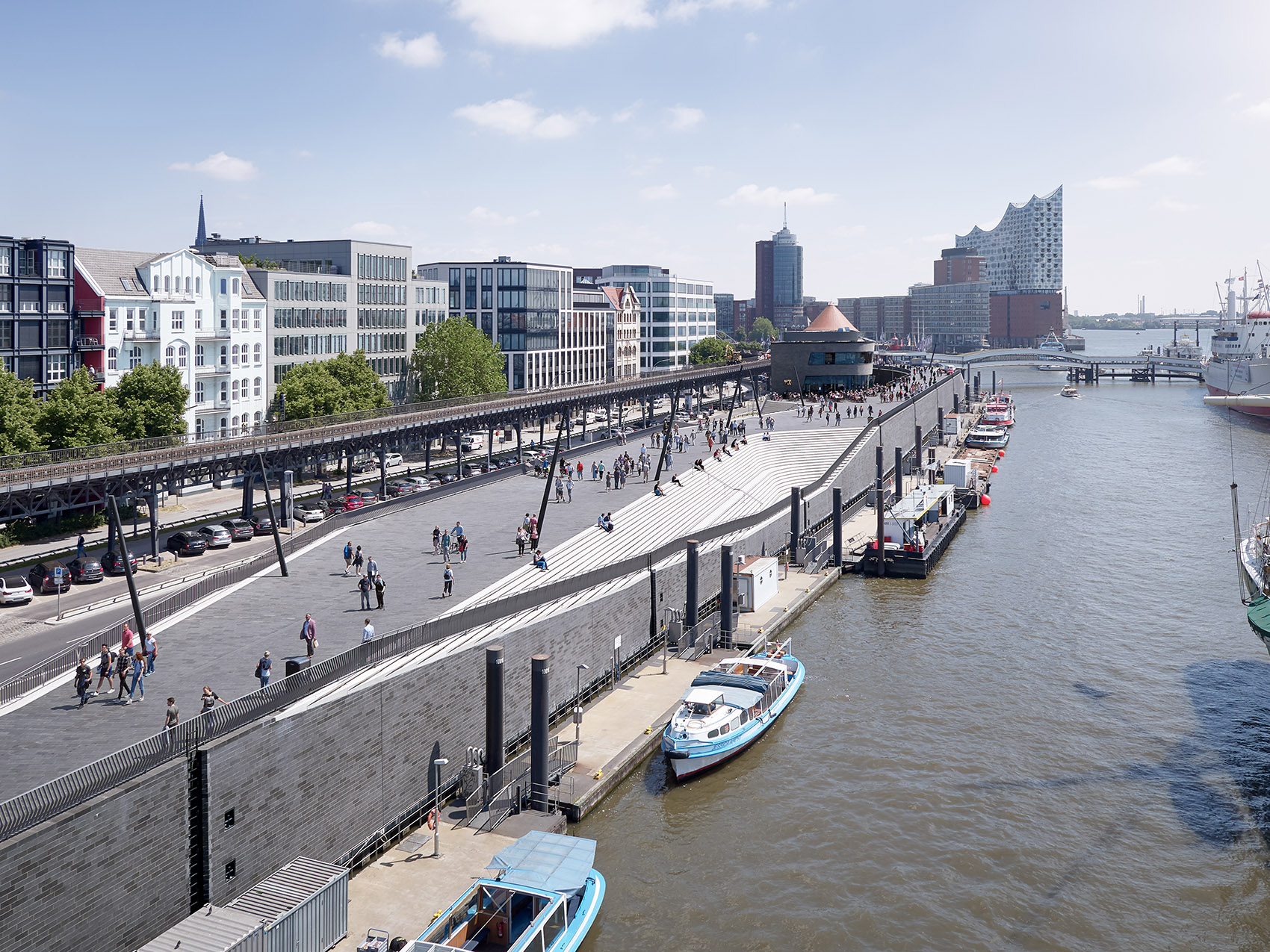
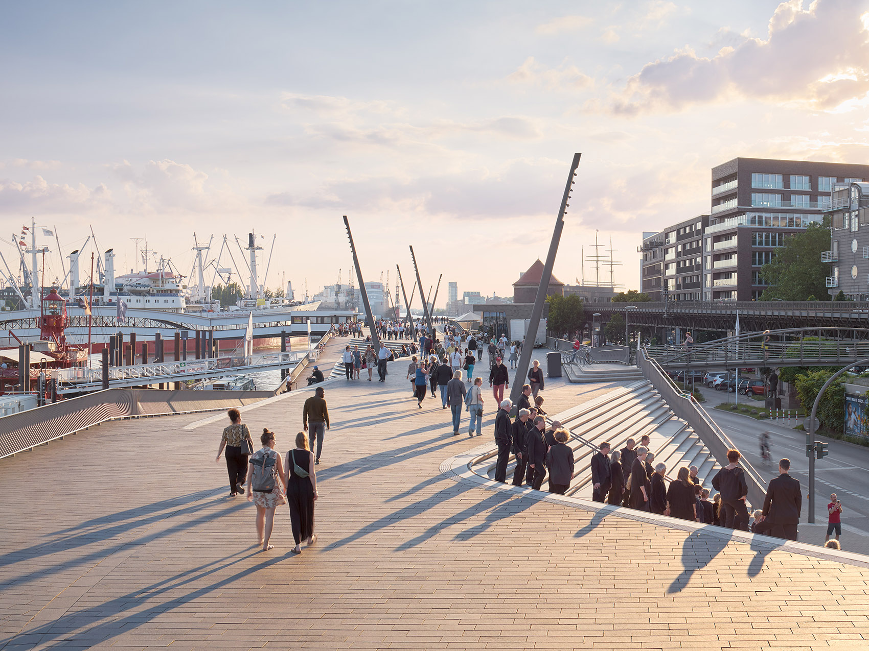
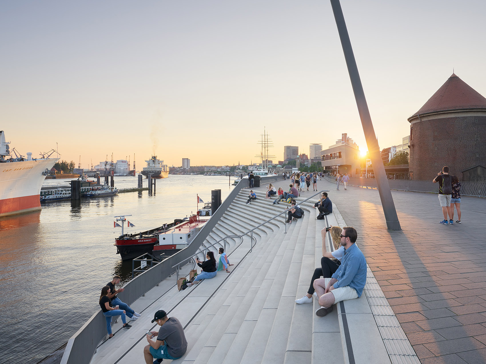
Niederhafen的防洪河堤位于一个十分突出的位置,并且与城市中著名的河滨走廊融为一体,成为汉堡最主要的旅游景点以及最重要的公共空间之一。步道被修建在河堤的顶部,带来朝向易北河与港口的壮观全景视野。在所有阶段的建设均完成之后,河滨走廊与周围的城市环境被重新连接起来,一方面成为了备受欢迎的河岸空间,另一方面也与附近的社区形成了紧密的联系。
Hamburg’s Niederhafen flood protection barrier is in a prominent location that incorporates the city’s renowned riverside promenade – a major attraction for tourists and one of Hamburg’s most important public spaces. Situated on top of the flood protection barrier, the promenade provides undisturbed views of the Elbe and the port. With construction of all stages now complete, Zaha Hadid Architects’ design for the redevelopment of Hamburg’s Niederhafen flood protection barrier re-connects its river promenade with the surrounding urban fabric of the city; serving as a popular riverside walkway while also creating links with adjacent neighbourhoods.
▼备受欢迎的河岸空间,a popular riverside walkway

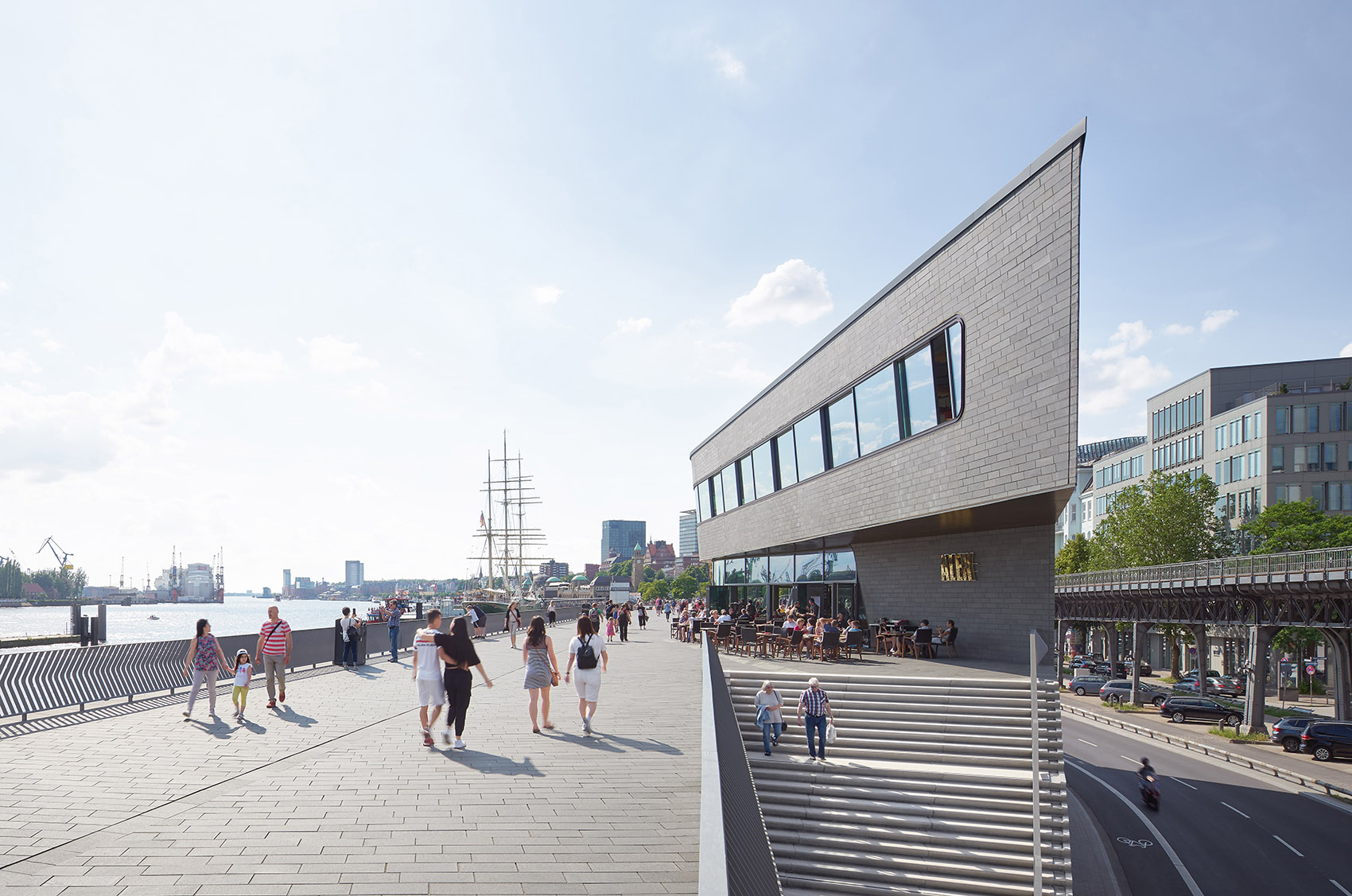
线性的结构在东段和西段的高度分别为海拔8.60米和8.90米,旨在保护城市免受冬季最强风暴潮和极端浪潮的影响。步道最窄处的宽度也足有10米,从而能够为行人、慢跑者、街头表演者、小吃店和咖啡厅提供宽敞的公共空间。商店和公共设施同样被包含在街道层,并且面对着城市的方向。
The linear structure is 8.60m above sea level in its eastern section and 8.90m above sea level in its western section to protect the city from maximum winter storm surges and extreme high tides. A minimum width of ten metres ensures this popular riverside promenade offers generous public spaces for pedestrians, joggers, street performers, food stalls and cafes. Shops and public utilities are also accommodated within the structure at street level facing the city.
▼步道最窄处的宽度也足有10米,提供了宽敞的公共空间,a minimum width of ten metres ensures this popular riverside promenade offers generous public spaces

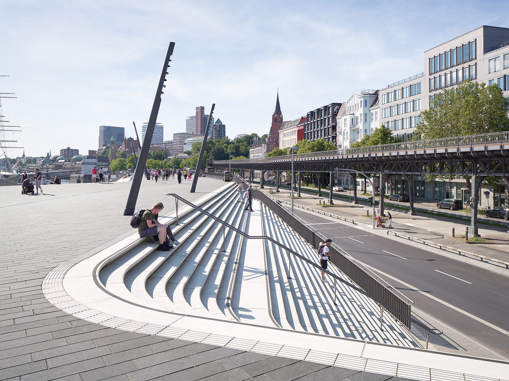
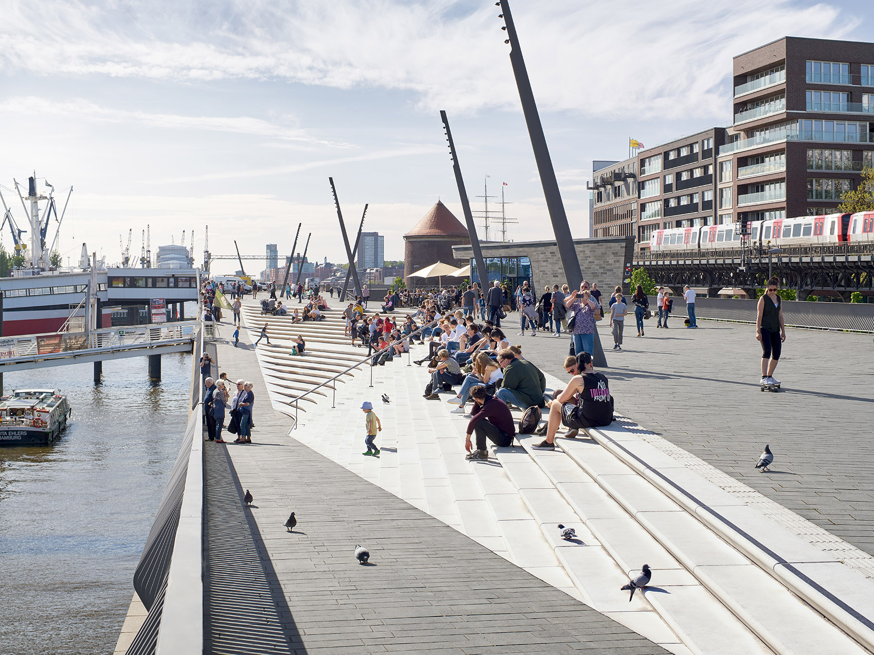
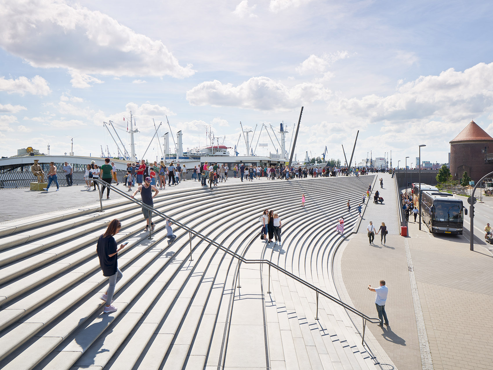
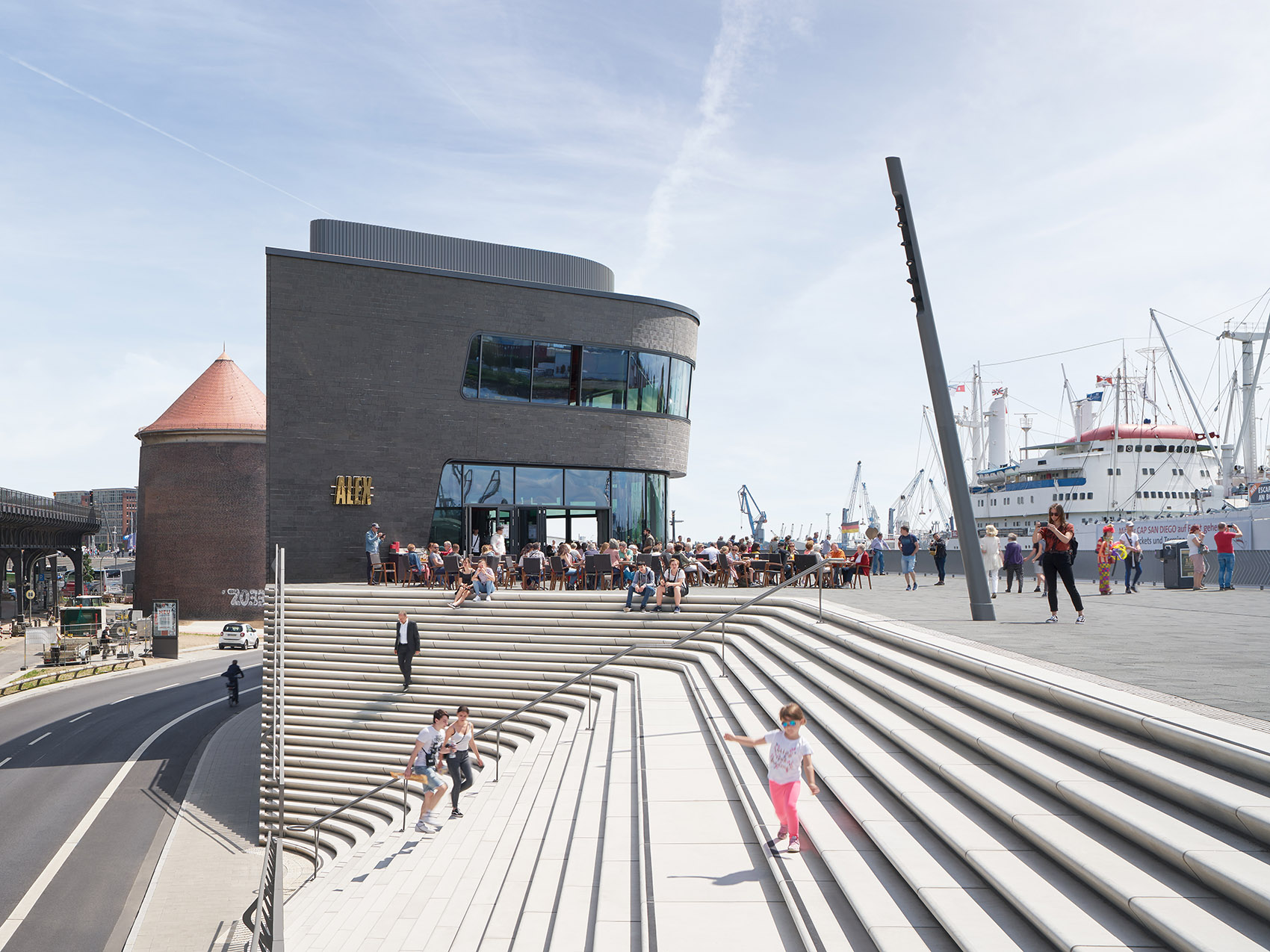
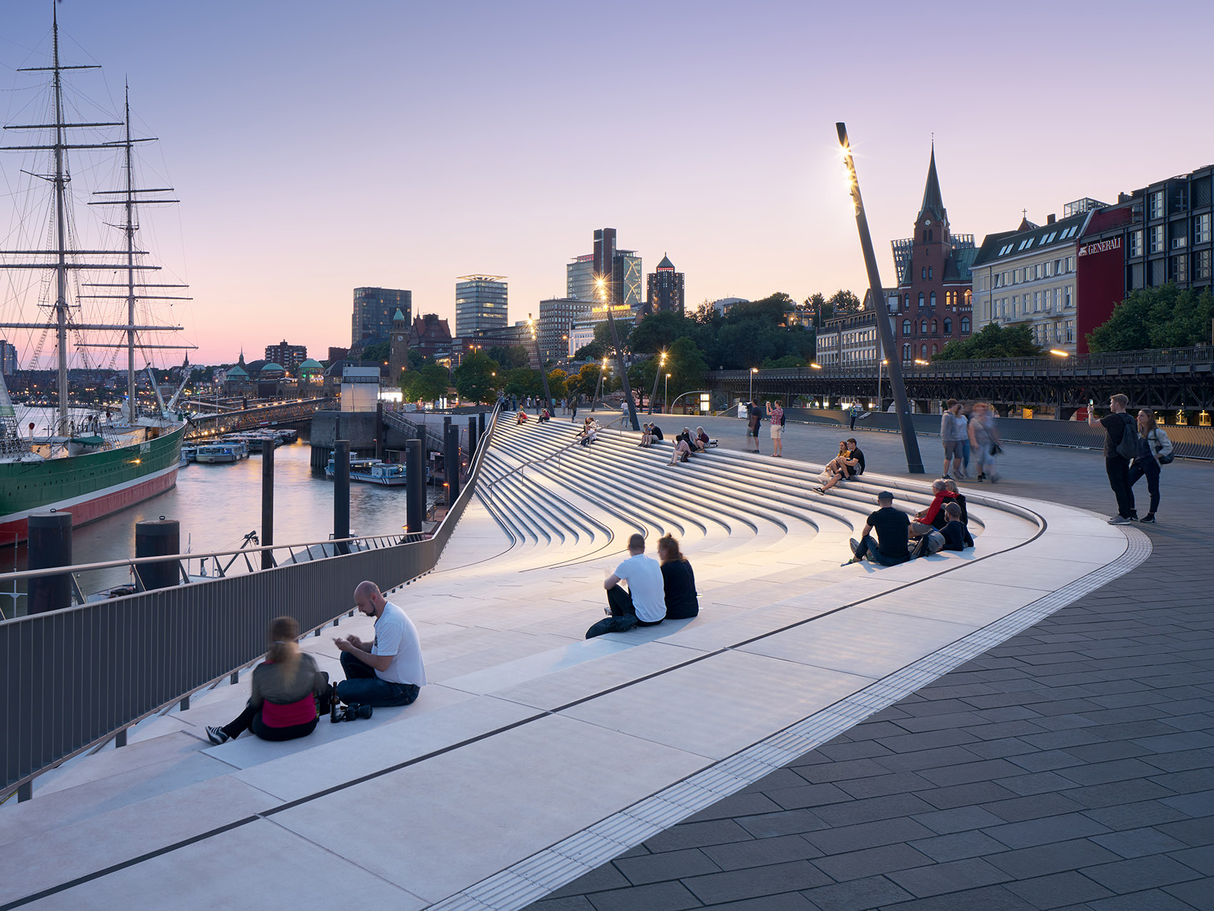
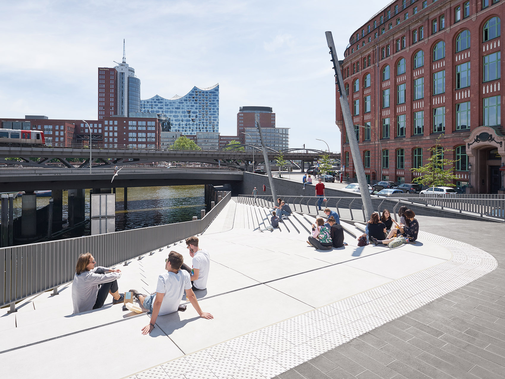
在社区街道与河堤相接的位置,宽阔的弧形楼梯带来一个形似露天剧场的空间,从这里可以同时看到沿着围栏散步的路人以及易北河上耸立着桅杆的游船。弧形楼梯也朝向相互交织的城市街道(包括Stubbenhuk, Neustädter Neuer Weg, Rambachstraße, Reimarusstraße和Ditmar-Koel-Straße大街),并将它们与河滨走廊连接起来。
Wide staircases resembling small amphitheatres are carved within the flood protection barrier at points where streets from the adjacent neighbourhoods meet the structure; giving passers-by at street level views of the people strolling along the promenade at the top of the barrier as well as views of the masts and superstructures of ships in the Elbe. These staircases are orientated towards their intersecting city streets: Stubbenhuk, Neustädter Neuer Weg, Rambachstraße, Reimarusstraße and Ditmar-Koel-Straße. New pedestrian crossings connect each street with the river promenade.
▼宽阔的弧形楼梯带来一个形似露天剧场的空间,wide staircases resembling small amphitheatres are carved within the flood protection barrier
▼弧形楼梯将河滨走廊与城市街道连接起来,new pedestrian crossings connect each street with the river promenade

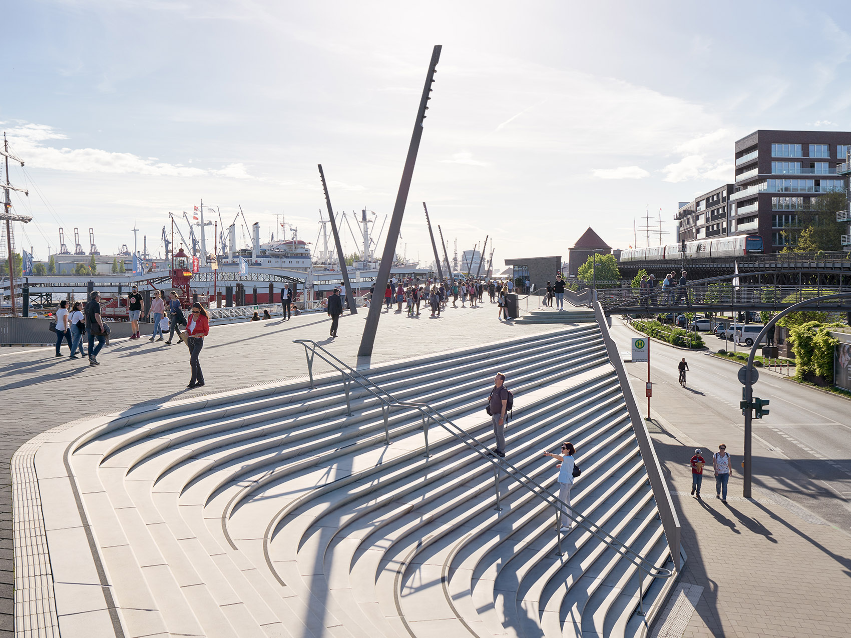
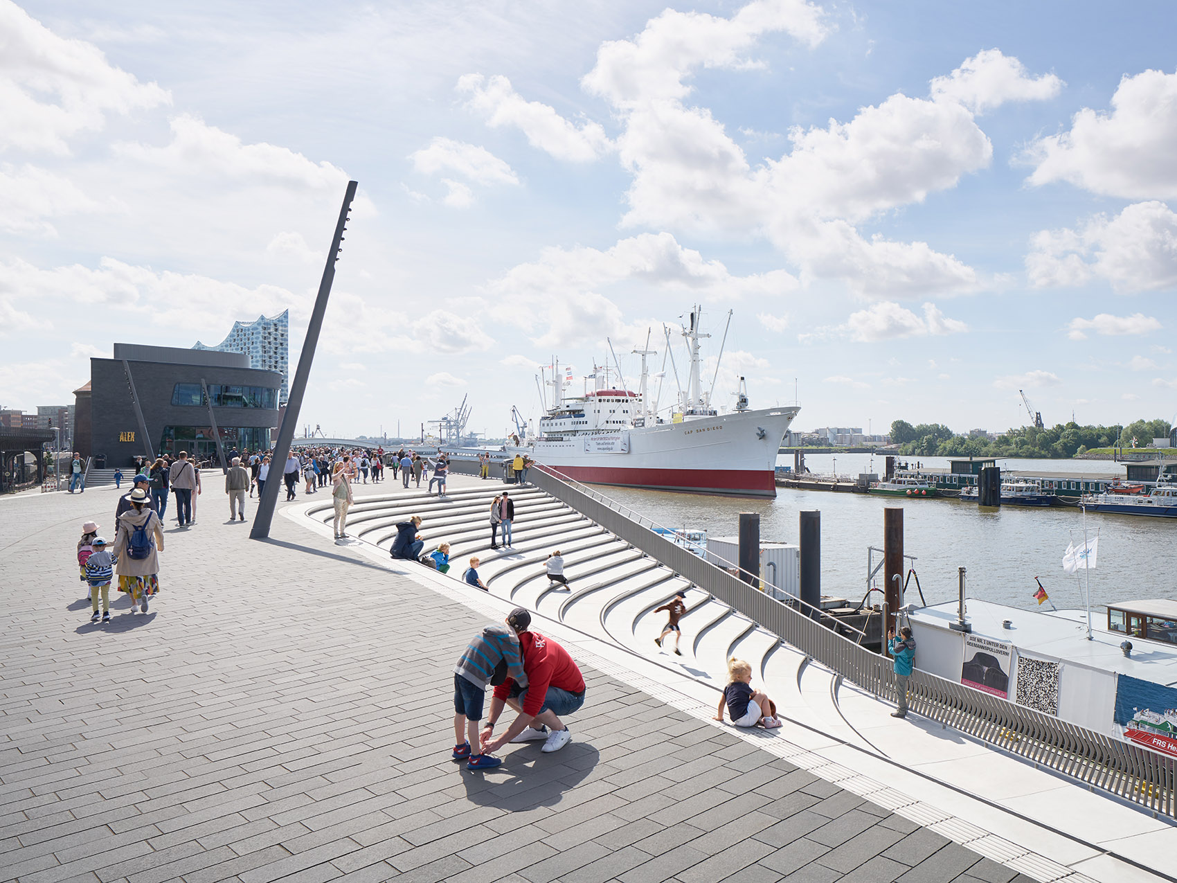
朝向河流与朝向城市的弧形台阶在结构中交替出现,沿着河岸形成一个宽度反复变化的、富有韵律感的空间序列。街道层的自行车专用车道沿着整个河堤延伸,Baumwell和Landungsbrücken的宽阔斜坡将河滨走廊与街道连接起来,提供了可供所有人使用的无障碍路径。此外还有一条位于中央的坡道,为车辆提供了通向河滨走廊和Überseebrücke的路径。
Alternating with these city-facing stairs, similar amphitheatres facing the river are also carved within the structure; generating an oscillating sequence in the river promenade as it repeatedly widens and narrows. Dedicated cycle lanes at street level run the length of the flood protection barrier. Wide ramps at Baumwell and Landungsbrücken connect the river promenade with street level and provide accessibility for all. A third central ramp enables service vehicles to access the promenade and Überseebrücke.
▼交替出现的弧形台阶形成一个富有韵律感的空间序列,amphitheatres facing river and city alternate to generate an oscillating sequence in the river promenade

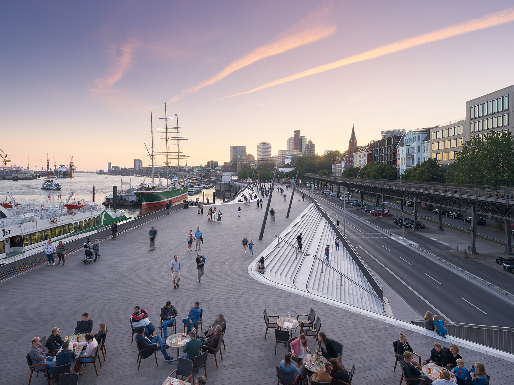
河滨走廊被分为东西两段,拥有不同的空间品质。西段的规模较大,提供了广阔的下游视野,能够将河流上航行的船只一览无余。东段的港口码头创造出更加亲密的氛围,人们可以经由“露天剧场”旁的长坡道直接行至下方的河岸边缘。
The river promenade is divided into two sections with different spatial qualities. The zone to the west is at a larger scale, offering wide views downstream of all shipping activity on the river. To the east, the port’s marina creates a more intimate atmosphere with a long ramp alongside the amphitheatre leading visitors down to the water’s edge.
▼长坡道通向下方河岸边缘,the long ramp leads visitors down to the water’s edge

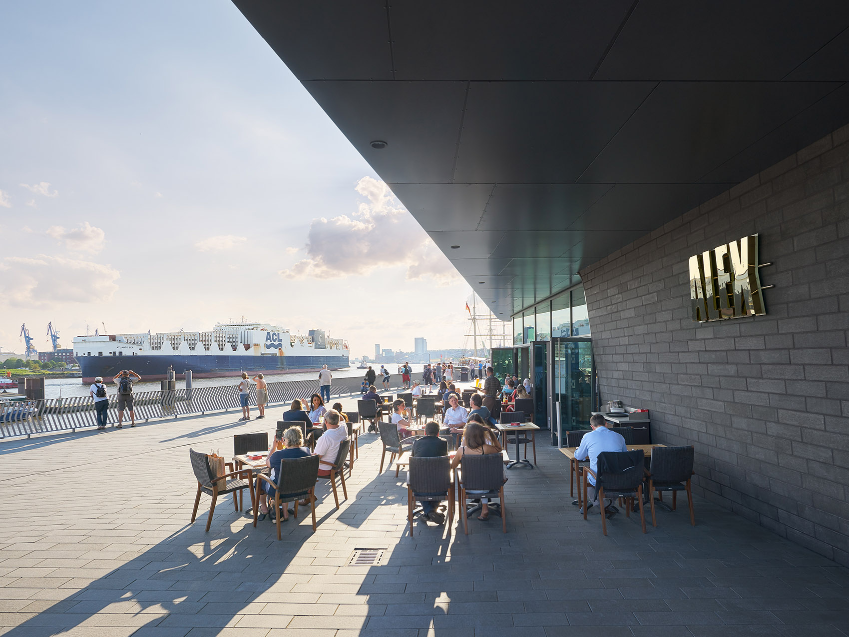
河堤上还坐落着一个三层的餐厅和两间小吃店。餐厅顶层以悬臂的形式与旁边的楼梯形成关联,并为客人带来易北河的全景视野。河滨走廊的人行道区域以炭黑色花岗岩铺设,与浅灰色的花岗岩台阶形成了鲜明的对比。
A three-storey restaurant and two food kiosks are integrated within the flood protection structure. The top floor of the restaurant cantilevers over its adjacent staircase and gives diners panoramic views of the Elbe. Pedestrian areas of the promenade are clad in a dark, anthracite-coloured granite that contrasts with the light grey granite of the staircases.
▼从阶梯望向餐厅,view to the restaurant

▼餐厅顶层以悬臂的形式与旁边的楼梯形成关联,the top floor of the restaurant cantilevers over its adjacent staircase

▼户外用餐区,outdoor dining area

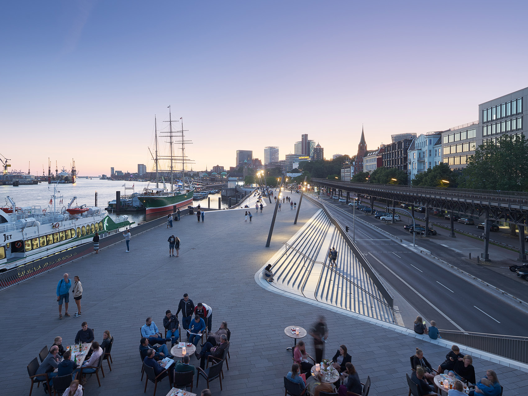
▼河滨长廊夜景,the River Promenade by night

▼码头鸟瞰,port aerial view